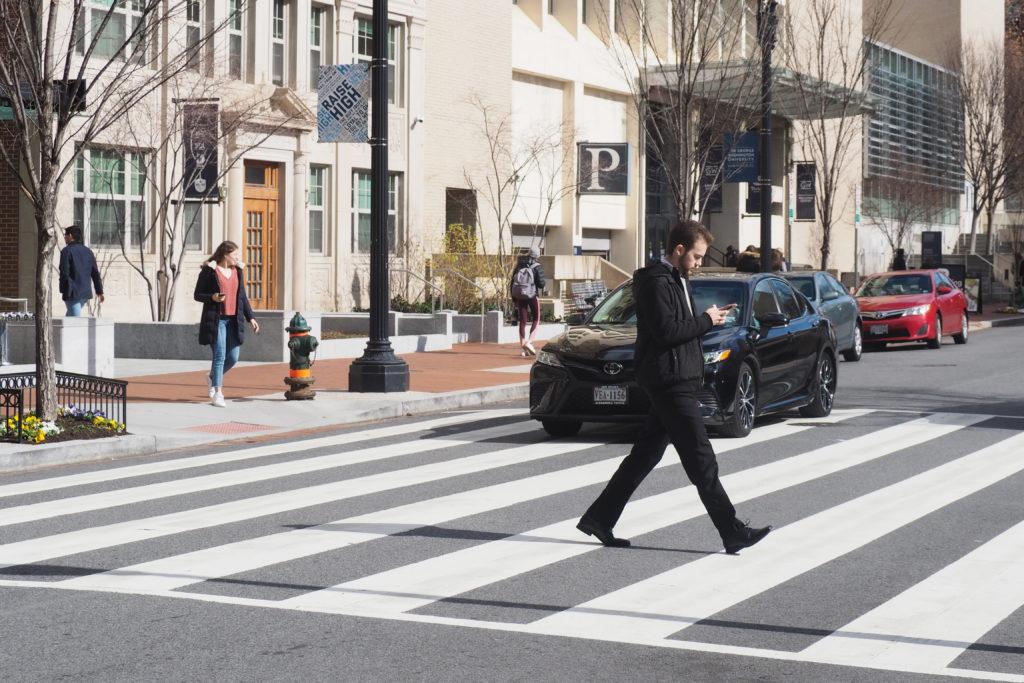
GW sits in an area of the city with some of the best roadways to walk to and from nearby amenities, a study from the D.C. Policy Center released last week found.
The report – authored by D.W. Rowlands, a graduate student studying human geography at the University of Maryland – revealed that the Foggy Bottom area ranks the highest of all D.C. neighborhoods for walkable density, which measures residents’ ability to walk to and from everyday conveniences, like work or the grocery store. The neighborhood boasts more than 10,000 activity units per square mile, the report found.
“Unsurprisingly, there is significant overlap between the areas with the best-connected street grids and the areas with the highest ‘activity densities’ (the combined density of residents and jobs),” the report states. “However, many of the denser portions of the suburbs still have relatively poorly connected street grids.”
Rowlands said she gathered population data and calculated how many people’s jobs were within a 10-minute walk of their home or a Metro station to produce a walkable density number for each neighborhood.
“We’re trying to understand, basically, how many people or how many destinations are near a given location, say how many people are near a transit station,” she said.
She said an area’s walking density depends on how populous the area is and how easily connected roadways are for pedestrians. Rowlands said she factored in distance between amenities relative to the mode of transportation, like walking or transit, that a person is using.
“You want to have as many people as possible living within walking distance of a finite and somewhat constrained number of stations,” she said. “The higher the walking density, the more passengers you can get for given transportation and even transit line.”
Transportation experts said high walkability ratings can encourage residents to walk to nearby locations, which is a healthier and more sustainable alternative to driving cars.
David Levinson, a professor of transport engineering in the School of Civil Engineering at the University of Sydney, said walking accessibility matters when people are choosing where to live. He said the more places that a person can reach in a short period of time, the higher the real estate market is in the area.
“People pay a premium (higher rents and land value) to live in places with high access by walking and public transport to jobs, shops, good schools and other amenities,” Levinson said in an email. “They pay a smaller premium for places with high accessibility by automobile.”
A report released late last year found that home sale prices in Foggy Bottom and the West End had increased by more than 40 percent in 2019.
Levinson added that city officials can time crosswalks to reduce pedestrian wait times and permit “high density developments” to increase walking accessibility in the city.
“Cities with dense street networks help, but the traffic signals also need to be timed so pedestrians don’t have to wait too long to cross the street,” he said. “If it takes two minutes to cross the street, that’s 20 percent of a 10-minute walk, and accessibility is reduced significantly.”
Kara Kockelman, a professor of civil, architectural and environmental engineering at the University of Texas at Austin, said city officials can improve an area’s walkability with additions like wide sidewalks or bulb-outs – added pedestrian waiting areas – at intersections. But she said vehicular transportation is sometimes unavoidable when getting to and from big shopping trips.
“If you want to bring home a lot of groceries or you want to bring home a new mattress, or you want to go buy clothes at a big shopping center, chances are that’s not going to happen without getting into a motorized vehicle to take care of that distance and that speed that you need,” Kockelman said.


